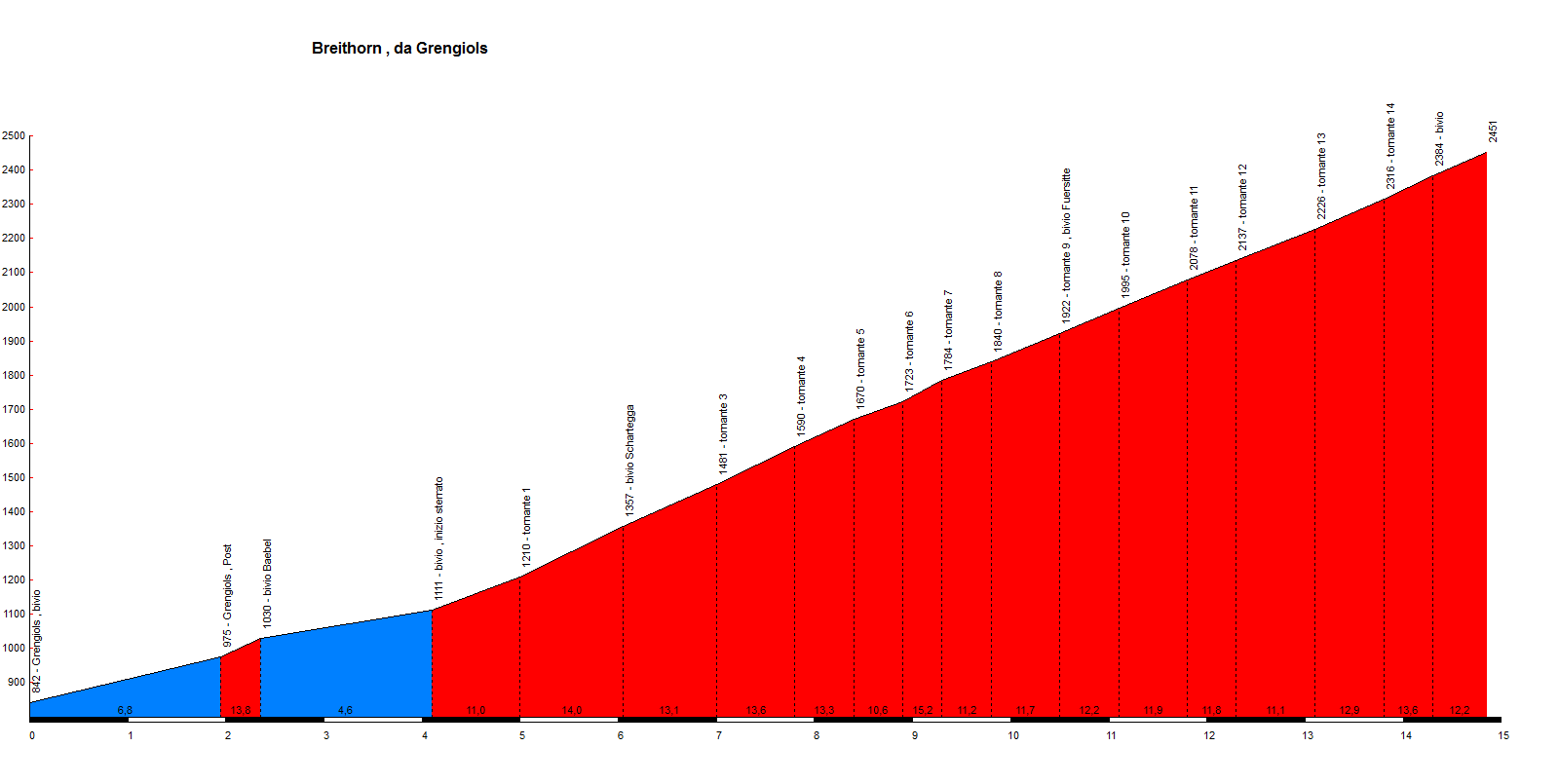
The climb starts in Grengiols; a village
situated 12 km east of Brig in the Swiss Canton of Valais. It can be divided
into two parts. The first 4.1 km are asphalted and only moderately steep, with
one exception. After the post office in Grengiols, it is possible to go straight
up to the church, and then left, on a cobbled street. The gradient exceeds 20%
on this short stretch.After rejoining the main road, the climb is then
relatively flat.After this first part finishes, the second part, measuring 10.8
km, begins. This is the military road built during the Second World War, and is
now closed to all motorised traffic except for inhabitants. From here until the
tree line at around 2000m, the road is hard earth and is in excellent condition
(comparable to the unsurfaced section of the Umbrail Pass); no problem with a
racing bike. Above the tree line, in particular between 12.5-14.3km, the
condition is a little less good, but still quite possible with a racer (similar
to the Colle di Finestre, better than Rionda, and much better than the Col de
Parpaillon, for example). From the last curve to the end, the road is in better
condition again. The views from the summit are spectacular: north to the Bernese
Alps, south across the Saflisch valley to the mountains on the Italian border.
Behind the pass, a simple road descends down to Heiligkreuz, then asphalted down
the Binn valley, and back to Grengiols: the upper part was built later than the
climb from Grengiols. The section down to Heiligkreuz is just about possible
with a racer. This is a very difficult, but also extremely beautiful climb:
highly recommended!.
| Autore: Michael Garrood | Mappa |